Soil horizons form through a variety of physical, biological, and chemical processes that affect materials at different depths within the soil. These processes include weathering, erosion, leaching, eluviation, illuviation, acidification, (de)calcification, (de)salinization, decomposition, mineralization, and many others.
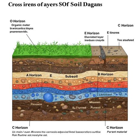
Soil profiles are vertical cross sections of the ground where distinct or indistinct layers, called soil horizons, can be observed. Soil horizons form through a variety of physical, biological, and chemical processes that change the soil profile at various depths within the soil. A soil profile is a vertical cross section of the ground. Soil horizons can show distinct or indistinct layers called soil horizons (see Figure 11).
In field practice, soils are described by master horizons labeled with capital letters O, A, E, B, C, and R, with some horizons containing transitional subdesignations. Master horizons are designated by the capital letters 0, A, E, B, C, and R where each master horizon indicates a certain set of properties in the soil. The sequence of horizons and horizon differentiation, for any given soil, is dependent on the soil forming factors.
Categories of Soil Horizons
Organic Horizons
- O horizon: refers to soils with more than 17% organic carbon (or ~30% organic matter by weight). O horizons occur where decomposition is slow, usually in wet or forested areas, and may have stages such as fibric, hemic, and sapric depending on decomposition.
- O horizons can be buried or present at the surface of mineral soils, and they are not necessarily saturated with water for prolonged periods.
- Horizon designations such as O, OH, or Oe may reflect varying degrees of decomposition and water saturation.
Mineral Horizons
- A horizon (topsoil): located in the zone of leaching and eluviation, with minerals washed down and organic matter accumulation from decomposing material.
- B horizon (subsoil): zone of accumulation and illuviation, where minerals such as clay, soluble salts, and iron may accumulate and minerals transform.
- C horizon (substratum): horizon little affected by pedogenetic processes, containing parent material that can weather to form solum.
- R horizon: bedrock layer beneath all weathered horizons.
- Other mineral horizons may occur as transitional layers (e.g., BC, CB, B/C) indicating mixtures or transitional changes between master horizons.
E horizon
E horizons are lighter in color than the adjacent A or B horizons, with lower clay content, and are often found in forested areas where eluviation removes finer particles and soluble compounds. E horizons are commonly differentiated from underlying B horizons by color, texture, or structure.
Formation and Processes
- Physical processes: weathering, erosion, and redistribution of minerals and organic matter through eluviation and illuviation.
- Biological processes: decomposition and mineralization of organic matter; plant nutrient uptake altering soil chemistry and color; soil fauna activity influencing structure.
- Chemical processes: acidification, calcification, leaching, and formation of secondary minerals, influencing horizon color and texture.
Weathering and erosion break down rocks, altering texture and appearance. Decomposing materials introduce nutrients into the topsoil that eventually move into lower horizons. Plants absorb nutrients from the upper layers, changing soil chemistry and possibly color depending on remaining nutrients. Acidic solutions in water can react with minerals and rocks, altering horizon appearance, texture, and chemistry. Leaching can remove salts and calcium, among many other elements, influencing horizon properties.
Soil Profiles Across Regions
Soil profiles vary across regions; no two profiles are identical due to differing soil-forming conditions, climates, time, parent material, organisms, and landscape positions. A general overview of major Canadian regions shows distinct soil characteristics influenced by glaciation, permafrost, bedrock depth, and tectonics. The Canadian Shield typically exhibits shallow horizons due to thin soils above bedrock. Prairie soils formed after glaciation are relatively young with high nutrient content supporting agriculture. Arctic regions may have permafrost, limiting weathering and horizon development.
Indigenous knowledge can contribute to understanding regional soils and landscape histories. Around 15,000 years ago glaciers receded north, exposing bedrock and forming the Canadian Shield with shallow horizons. Plate tectonics also influences horizon orientation and soil development, with mountain-building and island formation altering drainage and horizon positions. The prairie region, away from major tectonic plate edges, shows deeper bedrock and nutrient-rich soils due to glacial activity.
Practicalities: Observing and Describing Horizons
- A soil horizon is a layer approximately parallel to the surface with distinct characteristics produced by soil-forming processes.
- Soils are described using master horizons (O, A, E, B, C, R) and sometimes transitional designations (e.g., BC, CB, B/C).
- Horizon depth, color, texture, structure, and other properties are recorded to form a soil profile description.
- O horizons indicate organic material; A horizons indicate mineral soils with organic matter; E horizons indicate eluviation; B horizons indicate accumulation; C horizons indicate weathered parent material; R horizons indicate bedrock.
- In field practice, horizons may blur, and boundaries between horizons can be indistinct, requiring careful observation and sometimes laboratory confirmation.
When horizons boundaries are clear, the soil profile provides insights into drainage, wastewater movement, and potential suitability for uses such as farming or on-site systems, making horizon identification essential for land-use planning.
Measuring and Labeling Horizons
The depth of horizons is recorded from the soil surface, with examples like LFH 5-0 cm indicating an LFH layer on top of mineral soil measuring 5 cm. A horizon depth is measured from 0 cm to its end, while B horizon depth continues accordingly. In practice, soils may have patchy or overlapping horizons, and transitional horizons such as BC or CB may be present.
Soil classification and soil profile descriptions help in understanding a landscape, informing soil maps, and guiding land-use decisions. Master horizons provide a framework for comparing soils and interpreting their genesis and behavior, including how wastewater moves through the soil in on-site systems.
In field descriptions, a soil profile consists of the horizons exposed in a pit or road cut, including natural organic layers on the surface and altered geologic materials that influence genesis and behavior. The standard approach is to observe, measure, and describe horizons, then interpret the data for classifications and uses.
Notes on Regional Soil Systems and Examples
In Canada, five major regions illustrate diversity in soils: the Canadian Shield (shallow horizons, bedrock close to surface), the Interior Plains (young, nutrient-rich prairie soils), the Cordilleran and Appalachian regions (topographic complexity affecting horizons), the Innuitian Orogen (northern, arctic soils with permafrost), and coastal or eastern regions with varying drainage and organic matter content. Each region demonstrates characteristic horizons and profiles influenced by glaciation history, climate, and tectonics.
Soil Horizons
Soil horizons are useful for comparing ground characteristics between locations and for assessing suitability for farming or other tasks. The profiles help determine drainage, texture, and mineral movement through horizons, which affect land-use decisions and environmental health considerations.
Tables and Illustrative Data
| Master Horizon | General Characteristic | Typical Process |
|---|---|---|
| O | Organic matter-dominated; surface or buried | Decomposition, litter accumulation |
| A | Topsoil; mineral with organic matter | Leaching/eluviation of minerals; organic matter accumulation |
| E | Lighter color; eluviation-dominated | Loss of clay/organics via eluviation |
| B | Subsoil; illuviation and accumulation | Clay, salts, iron accumulation |
| C | Parent material; little pedogenesis | Weathering of parent material |
| R | Bedrock | Unweathered rock |