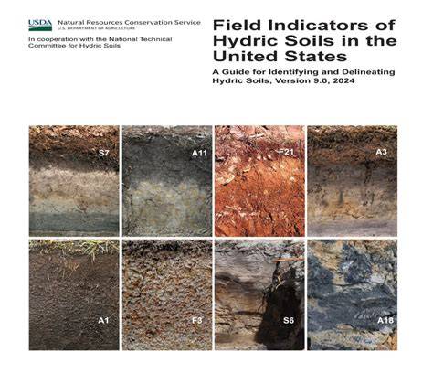
Hydric soils are defined as soils that formed under saturation, flooding, or ponding long enough during the growing season to develop anaerobic conditions in the upper part, and they include soils that experienced such conditions in the past but were altered hydrologically. A soil is inundated when the water table is at or above the soil surface, a soil is flooded when water moves across the surface, and a soil is ponded when water stands in a closed depression. Saturation is reached when the water table approaches the soil surface within specific depths depending on texture, with capillary rise contributing to surface moisture.
Field indicators provide efficient on-site confirmation of hydric soils, designed to identify soils that meet the hydric soil definition without extensive data collection. Some hydric soils have no field indicators yet recorded, requiring evidence to demonstrate that the hydric definition is met. The Hydric Soils Technical Standard (HSTS) offers a scientifically based approach to document soils that are saturated long enough during the growing season to be anaerobic, while field indicators serve as practical tools in many situations.
Key Definitions and Concepts
A hydric soil is a soil that formed under conditions of saturation, flooding, or ponding long enough during the growing season to develop anaerobic conditions in the upper part. This definition includes soils that developed under anaerobic conditions but no longer experience them due to hydrologic alteration, such as artificially drained or protected soils. Hydric soil indicators include muck, mucky texture, gley colors, and sulfidic odor, among other criteria listed in official field indicators and supporting references.
Map unit terminology clarifies how soils are organized for mapping and management. A map unit is a collection of areas defined and named the same in terms of their soil components or miscellaneous areas or both, while map unit components are the soils and miscellaneous areas within a map unit. A phase of a map unit is a subdivision based on features that affect use and management, such as slope, surface texture, stoniness, or thickness.
Criteria for Hydric Soils and Updates to NASIS
Criteria used to identify soils unique to hydric soils have been established to help identify map unit components associated with wetlands. The National NASIS database selection criteria for hydric soils were updated to cover a broader scope, converting from a national list of hydric soil series to a comprehensive list of all map units with at least one hydric map unit component. The updated criteria consider soils that meet Field Indicators of Hydric Soils or show evidence that the soil meets the hydric soil definition, including components that are frequently ponded or frequently flooded during the growing season for long durations.
Selected suborders and great groups, including Albolls, Historthels, Histoturbels, and various Andic, Cumulic, Pachic, or Vitrandic subgroups, are evaluated based on the range of characteristics of their soil series and their potential to meet Field Indicators of Hydric Soils or to demonstrate hydric soil status by other evidence. A map unit component that is hydric may also include portions that are non-hydric, given cross-boundary boundaries within the map unit.
Field Indicators and Process for Verification
Field indicators are soil characteristics documented to be strictly associated with hydric soils and provide an efficient on-site means to confirm hydric soil presence. The indicators are designed to identify soils meeting the hydric soil definition without further data collection, though some soils may require broader supporting evidence. The Field Indicators of Hydric Soils in the United States, maintained by NTCHS, are complemented by ongoing development and testing of additional indicators.
The Hydric Soils List supports land-use planning, conservation planning, and wildlife habitat assessment by identifying soils likely to be hydric and thus associated with wetlands. To classify an area as jurisdictional wetland, hydric criteria must be met along with hydrophytic vegetation and wetland hydrology definitions.
Hydric Soils in Practice
In mapping and land-use planning, hydric soils help identify wetlands and support restoration efforts. The Web Soil Survey and other interactive maps allow users to display hydric soils and various soil properties, aiding stakeholders in decision-making. The Hydric Soils List, Hydric Soils Rating map, and related resources such as official soil series descriptions and the NASIS database provide comprehensive data for assessment.
Understanding the relationship between hydric soils and hydrophytic vegetation is essential for accurate wetland delineation and regulatory classification. The Wetlands Delineation Manual and related regional supplements guide practitioners in applying hydric soil criteria alongside vegetation and hydrology indicators.
Additional Context and Resources
Several sources discuss the broader context of hydric soils, including the interplay of soil texture, water regime, and organic matter accumulation. The dynamics of gleyed, depleted, or mottled horizons reflect varying hydrology across landscapes, while organic soils such as muck and peat illustrate how prolonged saturation can influence soil morphology.
For practical access, choose a state to obtain hydric soils reports from Soil Data Access, and consult tools like the Web Soil Survey for user-friendly data visualization. The Technical References section includes a bibliography of hydric soil research, including work on soil indicators, hydrology, and the development and application of the hydric soil technical standard.
Tables and Data (Illustrative)
Table: Hydric Soil Indicators (selected)
| Indicator | Significance | Notes |
|---|---|---|
| Muck | Organic soil evidence | High decomposed plant material |
| Mucky texture | Surface texture indicating saturation | Common field indicator |
| Gley colors | Reduces with prolonged saturation | Grey-blue hues in horizons |
| Sulfidic odor | Anoxic conditions with sulfide accumulation | Environmental cue in field |
Additional data sources include the official soil series descriptions, the NRCS soils taxonomy framework, and wetland-related manuals and publications referenced in hydric soils literature.